Saturday, August 26, 2017

This is My Pennsylvania - Pennsylvania Long Rifles

 
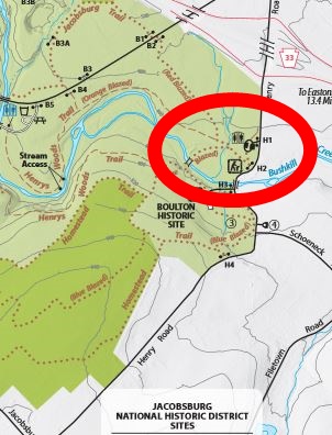
Park in the Boulton Historic Site parking area, the one that has a restroom.
 If you see the above signboard, you will know you are in the right area.
 Take the trail that is between this signboard and the No Fires or Camping sign.
 When you get to this Y with the little footbridge over the Bushkill Creek, turn left.
 Take a little look backwards and enjoy the view of the creek under the bridge.
 Then....cross the BIG bridge over the Bushkill Creek.
 Enjoy the signboards along the way.
 
 
 Follow the trail till you have to choose right or left, hint...choose left.
 When you get to the end of this trail, you will see this barn which is part of the Henry Homestead. Turn left. 
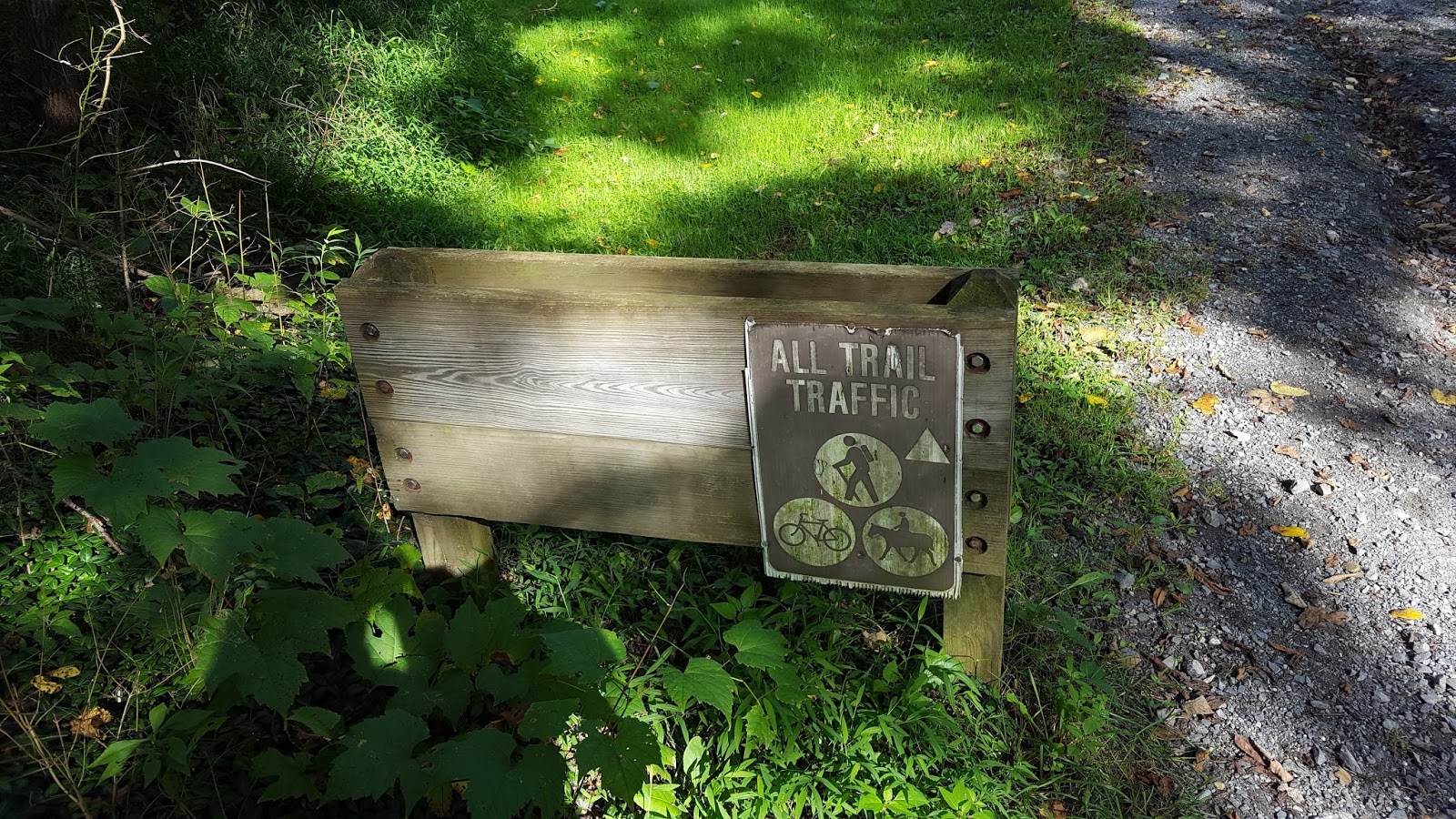
 Then turn right when you see this all trail traffic sign.
 Walk up the steps and meander on this trail which is close to the road, until you reach the Then and Now signboard.
 Notice this huge rotting stump across the trail. There are several moss covered fallen trees behind it.
 
 BIGGGGG rotting stump!
Look beside the short piece of mossy log.
 After logging in, take a little walk further down the trail to see the rest of the Henry Homestead.

Tuesday, August 08, 2017

This is My Pennsylvania - Snowmobiling AQ 284612

 
 Once you have finally found this little park, admire the Warming Hut and then head for the big parking lot across the road.  The roads into the park were blocked off when I visited in August, my guess is that they are only open during skiing season.
 Head to the Mainline trail which is close to the entrance of the parking lot.
 Walk a little bit down the trail, about 150 steps, and look into the woods on the left for some rocks which are behind an eight foot stump.  The rocks are a little hidden by the undergrowth.
 Walk off trail about eight steps to the biggest of these rocks.
 Look on the backside of the rock for a camo jar.

This is My Pennsylvania - Mingo Indians AQ 284605

 This is a way out of the way park in the SW corner of Pennsylvania, almost in West Virginia.  This park was created to help fulfill Governor Gifford Pinchot's promise that there would be a state park within 25 miles of every citizen.  The park seems to be in a valley with all trails going steeply uphill.  I did find one trail which was fairly level at one point.  Park in the parking lot below.
 Cross the iron bridge.  Don't be startled as I was by the sound of unexpected voices.  I saw that fishermen liked to fish from under the bridge.
 When you reach this sign, choose the Iron Bridge Trail.
 Go up the little bit of elevation which was in a very pretty woods.
As you get close to the top, notice the tree below on the right side of the trail.  It is a thick trunked tree with many thick arms high above the trail.
 Closer picture.
 Soon, I think about 15 to 20 steps later, notice the tree configuration below.  I lost my directions so I am guessing at the distance.
Behind the V tree you will see two moss covered logs. Look in the V where the two logs meet.
  
Enjoy the bridge view on your way back to the car.

This is My Pennsylvania - Kalmia Latifolia AQ 284598

 Head down the Lincoln Highway, Route 30, in Boswell until you see this sign on the north side of the road.  When you see it, turn left and then a second left into the parking lot for the Laurel Highlands Hiking Trail.
 Enjoy the various pretty sights.
 Cross over the little tree trunk bridge, pass the trail register and turn right on the blue blazed trail.
 
 Walk until you see the blue blazed tree sitting right on the edge of the right side of the trail.
 Stand beside the tree and note the three trunked tree about 15 steps away.  This tree has one rough trunk and two smooth trunks.
 
 Go around to the back of the three trunked tree and check out the little cubby hole in the bottom.  Please do not remove the debris that I put in the  hole to prevent the box from disappearing if the hole should get a little deeper.